Gps is a service available in most carry on devices particularly mobile phone and tablet. This can be effectively used in the study of large areas where we later take help of tools like google maps and google earth.I am writing this for the benefit of all those who are unaware of these wonderful tools, just like I was until I discovered their advantages.
My devices:
-Android phone on which I have installed a free application called ‘my tracks’ . 3G data connection
-My computer in office to which I have data connection.
1.During travel/study on site:
-When I travel light, I carry only my phone with me. I keep the ‘my tracks’ application on. I mark a start point, and then go about walking. After 3-4 hours I look back at my phone and the application has recorded all my moves, elevation, speed, distance etc.
2.Using it right:
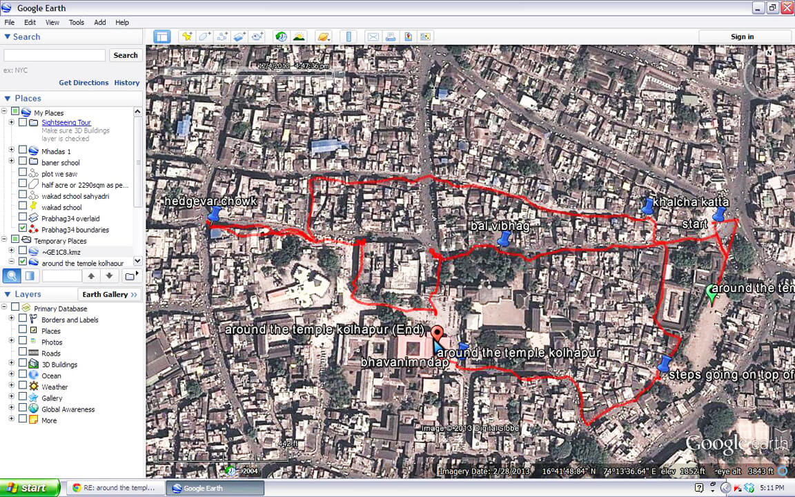
-My path recorded by the application can be shared through email to the computer. At the receiver’s end, it can be opened in google-maps on their respective computers.This file which gets exported has a .KML format. It can also be opened in google earth.
3.Google earth:
-Google earth is another software which is used by architects. This is a better platform, but unfortunately it cannot be accessed on android phones. Google earth works in a .KMZ format.
-Google earth is downloaded on my computer.In google earth I can add layers of images,boundaries, pinpoints, notes etc. I can then email each of those to my partners in the project. They get a .KMZ file in their inbox. It opens in google earth on their respective computers.
4.Use of these tools:
-To go for a trek to desolate areas and then be able to mark it on google earth to see the time, distance, important signs, important trees, locations and features.
-As architects we study a place and then go back and cross check things on maps which only acts as a 2 dimensional site map. These tools can help us to be synchronized with the map while we move.When we return we can cross check time taken,experiences, difficulty levels and other unmarked features to the same map.
-I recently used this tool to plot my path on a trek to Masai Pathaar near Panhala. It also helped me plot my way through the narrow by-lanes of old Kolhapur city which are invisible to satellite’s eye.I then shared my path with my students who marked their observations too.